Table of Contents
Introduction – Why Every Boater Needs a Navigation Strategy
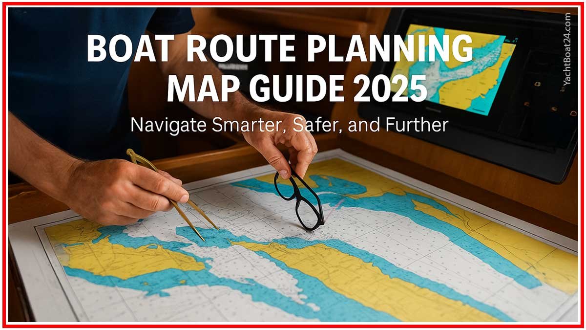
Boat route planning, every captain knows that reaching the horizon is a combination of skill and planning. Whether you’re embarking on a weekend coastal cruise or charting a multi-day offshore journey, a boat route planning map isn’t a luxury—it’s your roadmap to safety, efficiency, and confidence. In 2025, modern navigational tools offer real-time weather overlays, satellite tracking, and tidal modeling. Yet nothing replaces the reliability of understanding your route’s deeper context. This guide blends traditional charting with modern tech, showing you how to create a seamanship foundation resilient to signal loss, weather shifts, or unexpected encounters at sea.
Understanding Nautical Charts – What They Show (and What They Don’t)
At first glance, charts seem dense: numbers, symbols, and curving lines. Yet each element is essential. Raster charts provide faithful scans of paper maps, preserving notes and marks. Vector charts are dynamic, reflowing text and symbols based on zoom level. Pilot books add narrative detail: hidden shoals, sheltering bays, or ideal night anchorages. Whether you’re tracing depth contours, identifying navigational aids, or avoiding submarine cables, a boat route planning map must be decoded carefully. In practice, chart colors reveal depth danger—blue hues for shallows, white for safe passages—while dashed lines signal limits or route corridors.
Yet charts don’t show everything. Charts rarely include boat traffic density, recreational zones, or water quality data. That’s where your planning—layering chart data with firsthand knowledge, weather forecasts, and crowd-sourced route logs—makes all the difference. A sailor who trusts a single chart risks misjudging tidal misalignments, current shifts, or depth discrepancies caused by recent storms.
Manual vs. Digital Navigation – Strengths and Weaknesses
Paper charts remain steadfast guardians when electronics fail. No battery needed, no signal interference, just a pencil and symbols you understand. In fog or position drift, you can always cross bearings with a hand-held compass—classic seamanship at work.
Digital platforms, however, offer transformative benefits. Navionics, iNavX, and C-Map allow real-time charts, AIS overlay, weather layers, and auto-rerouting based on depth alerts or storm threats. But they also invite pitfalls: screen glare under bright sun, overreliance on GPS causing “navigational blindness,” or outdated chart downloads risking misplaced depth cues.
A wise navigator uses both by studying the paper route before launching, marking it, and then overlaying it digitally. If the tablet fails, the plan lives on paper—a thriving backup that defies battery failures or app freezes.
Mapping Tools and Devices to Use in 2025
In today’s marine world, navigation is smarter—and more interconnected—than ever. But even with advanced gear, the heart of every good plan remains the boat route planning map.
Plotters and Integrated Navigation Systems
Modern chartplotters like those from Raymarine, Garmin, or Simrad integrate sonar, radar, AIS (Automatic Identification System), and real-time charting into one unit. These offer HD touchscreen interfaces, predictive routing, collision avoidance, and weather sync features. Some even record your previous routes to suggest optimal paths based on past performance.
Mobile Apps and Tablets
Apps like Navionics Boating, C-MAP, and Savvy Navvy allow route drawing, tide forecasting, wind overlay, and even anchor alarms—all from your phone or tablet. In 2025, tablets with LiDAR support even improve harbor depth estimation, adding another layer of safety.
Offline Maps and Redundancy
No matter the tech, redundancy is essential. Always download offline boat route planning maps for your entire route and adjacent escape paths. Bring a waterproof pouch and a second device or USB backup with updated charts.
Paper Still Matters
Pair all this tech with a waterproof printed chart of your area, marked with key waypoints, harbors, and emergency safe zones. It may feel old-fashioned, but it’s your fail-safe navigation anchor.
Strategic Waypoint Planning and Risk Assessment
Every nautical journey should begin with the question: “Where can I go safely, and what can go wrong?” Using your boat route planning map, plot every major waypoint—not just for beauty, but for strategy.
Mark areas for:
- Fuel stops
- Weather shelter
- Anchor-friendly coves
- Marine service access
Your plan should also include diversion routes. What if wind shifts? What if your engine fails? Include time-based checkpoints. A delay of over two hours from your expected position could mean trouble—or worse, trouble ignored.
Risk assessment includes:
- Navigating during daylight hours whenever possible
- Knowing your boat’s range with and without motor assistance
- Understanding maritime zones (e.g., military or fishing regions)
Combining these considerations with your boat route planning map ensures you’re not just guessing—you’re anticipating.
International Sailing Routes and Zoning Laws
Crossing into international waters adds layers of complexity—and risk. Whether you’re heading from Florida to the Bahamas or hopping Greek islands, your boat route planning map must reflect legal and geopolitical boundaries.
Maritime Zones Explained
- Territorial waters extend up to 12 nautical miles from a country’s coast.
- Contiguous zones (up to 24 nm) allow limited enforcement by coastal states.
- Exclusive Economic Zones (EEZs) stretch up to 200 nm and may affect fishing, anchoring, or seabed exploration.
Some regions, like the Mediterranean, involve complex permissions for mooring or overnight anchoring, especially near protected marine parks or heritage zones. Your route must not only be practical but also compliant.
Clearance and Documentation
Always plan your customs check-in points and prepare necessary paperwork (passports, insurance, vessel registration). Apps like Noonsite or Navily help cruisers stay updated on port regulations and seasonal closures.
And don’t forget local rules: in Croatia, for example, some islands prohibit anchoring without permits due to seagrass protection, and violating these rules may cost you over €1000.
User Mistakes in Mapping – And How to Avoid Them
Even seasoned boaters can misjudge a boat route planning map if overconfident. Common mistakes include:
- Ignoring scale – confusing miles with nautical miles or using zoomed-in views too soon
- Over-reliance on auto-routing – trusting app-generated paths without verifying depth or hazard warnings
- Neglecting time-based navigation – planning through shallow straits during low tide
- No weather window margin – not budgeting extra days for storm delays
Smart sailors develop a “pre-departure checklist” for map cross-referencing: paper vs. app, plotter vs. forecast, logic vs. optimism.
Planning isn’t paranoia—it’s seafaring wisdom.
Video – Boat Route Planning Map

FAQ – Boat Route Planning Map
This website offers general information for your convenience. YachtBoat24.com makes no warranties, either express or implied, and all use of this site is at your own risk. We are not responsible for third-party content linked to or from this site.